CYCLONES AND THE PANDEMIC...
POST BY: Ganesh C L
In the ongoing COVID-19 crisis across all the countries, another hit from nature is upon us. Nature has taken yet another form of disaster in the form of Cyclones in the south pacific and Indian ocean and as Typhoons in the northwest pacific ocean. Tropical cyclones /hurricanes are the most powerful weather events on Earth
A typical cyclone(or a typhoon or a hurricane or a Storm) is a system of winds rotating inwards to an area of low pressure, with an anticlockwise(northern hemisphere) or clockwise(southern hemisphere) circulation.
There are seven categories of cyclones mentioned by the Indian meteorological department(The other oceans in the world have a separate classification.. If you need more info about it, the links down in the reference section).
 |
| Source: Wikipedia |
And currently, we have two of these. One is the Amphan cyclone in the north Indian ocean and Vongfong typhoon in the Pacific.
AMPHAN- THE WORST CATEGORY CYCLONE
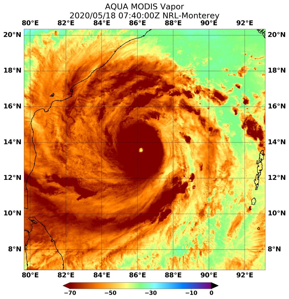
When NASA's Aqua satellite passed over the Northern Indian Ocean on May 18, it gathered water vapour data that showed the intensity of a powerful Tropical Cyclone Amphan.
Cyclone Amphan developed into a super cyclone in the Bay of Bengal on Monday afternoon. It has been 21 years since the last Super cyclone hit India. The 1999 Odisha Cyclone had fatality cases of 9887(Using IMD figure. Some estimates range up to 30,000) and damaged around $4.44 billion(1999 USD value) across Thailand, Myanmar, Bangladesh and India's Odisha.
 |
| On May 18 NASA’s Aqua satellite passed over Tropical Cyclone Amphan, located in the Northern Indian Ocean. Aqua found the highest concentrations of water vapour (brown) and coldest cloud top temperatures were around the clear eye. Credits: NASA/NRL |
The satellite's data as of 18th May showed that the lowest temperature as lowest as minus 56.6-degree celsius. Its images showed the highest concentration of water vapour ad coldest cloud top temperatures circling the visible eye of the cyclone.
 |
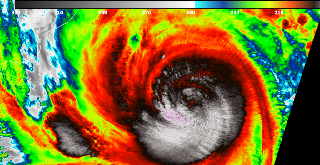
| NASA-NOAA’s Suomi NPP satellite passed over Tropical Cyclone Amphan on May 18 at 4:28 p.m. Cloud top temperatures were as cold as minus 80 degrees Fahrenheit (minus 62.2 Celsius), indicating powerful storms. Credit: NASA/NOAA/UWM-CIMISS, William Straka III |
On May 19, Amphan was located about 377 nautical miles(1 nautical mile=1.85kms) south-southwest of Kolkata, India. It was moving to the north-northeast and is weakening as it moves.
National Disaster response force has taken measures to provide rescue and relief to the affected areas. It has evacuated thousands of people to safe zones.
Tuhin Ghosh, director of the School of Oceanographic Studies at Jadavpur University, said to Hindustan Times "The damage that Amphan can inflict will depend much on the direction in which it travels and the timing of the landfall. If it hits in a south to north direction and there is high tide at that time, the damage could be more. That’s what happened when cyclone Aila hit Sagar Island in May 2009. But if it travels in an oblique direction and there is low tide, then the damage could be less, as was seen in November 2016 when Bulbul hit the Bengal coast."
TYPHOON VONGFONG IN WESTERN PACIFIC
Also known as Typhoon Ambo in the Philippines, Formed on 10th May 2020 and dissipated on 18th May 2020. it has fatalities of 5 and 2 missing cases. It caused damage of worth $20.5 million over the regions of Palau and Philippines.
 |
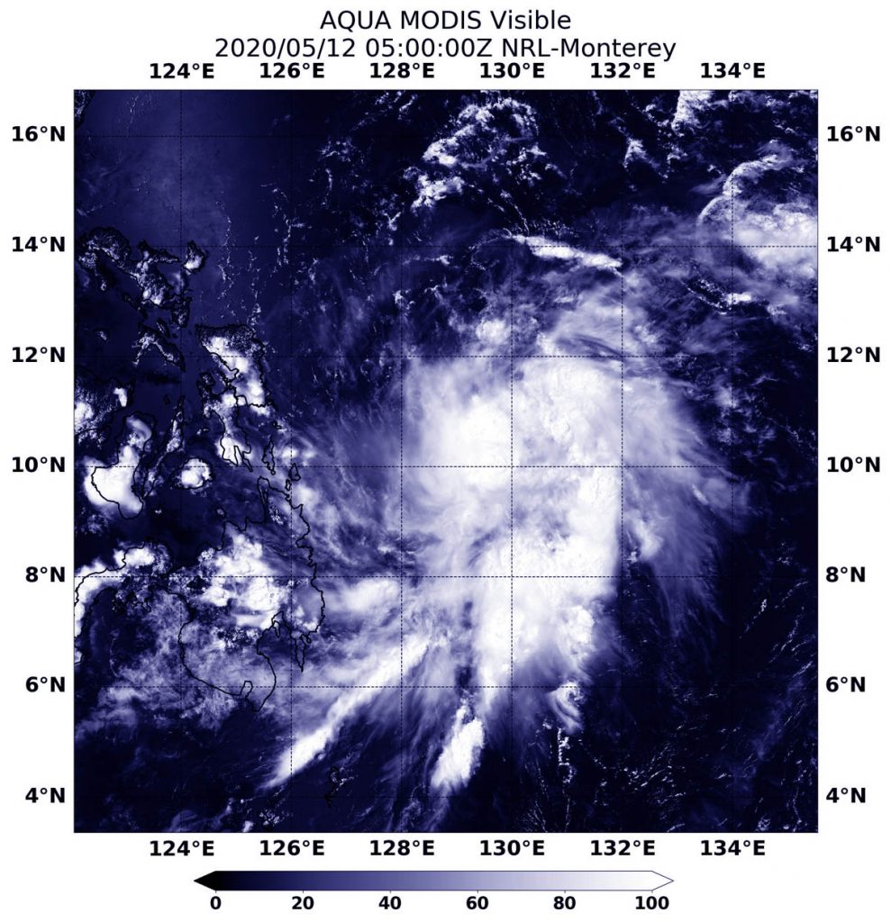
| On May 12, 2020, the MODIS instrument that flies aboard NASA’s Aqua satellite provided a visible image of newly developed Tropical Storm Vongfong, known locally in the Philippines as Ambo, in the Northwestern Pacific Ocean. Credit: NASA/BRL |
 |
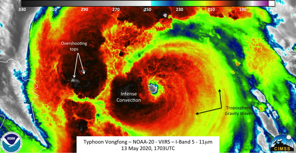
| The NOAA-20 satellite saw Typhoon Vongfong at 12:03 p.m on May 13. The imagery showed features that are expected from an intensifying storm, including overshooting tops and tropospheric gravity waves. In addition, a clear eye could be seen as well. Credit: NOAA/William Straka III, Univ. of Wisconsin Madison |
WHAT'S THE CONNECTION BETWEEN PANDEMIC AND THE CLIMATE CHANGE
Going through an article in Aljazeera on this, my opinions resembled. The two catastrophes have a common root. Their roots lead to the present economic model- the pursuit of humans for infinite growth at the cost of Nature on which his own survival depends.
Humans have been harvesting every possible resource on the planet and using it for their economic activities and at the same time, this adds a lot of waste to the environment(A great example is the Emissions of gases).
This process has made nature lose control of its balance and disrupted ecological cycles. The need for more natural resources has forced humans to explore and get exposed themselves to yet unknown pathogens.
Another article I read, said that Reduced particulate matter emissions during the lockdown meant fewer aerosol particles, such as black carbon, that are known to reflect to reflect sunlight and heat from the surface. This has increased the temperature if the surface and caused depression in the oceans thereby inducing such disastrous cyclones.


Thanks for interesting explanations of Cyclones and Typhoons. These natural disasters only make it harder for people in the time of the pandemic. Evacuations have to be done. Social distancing has to be maintained. Ecological cycles are hurt. It's always one disaster after another for humans.
ReplyDeleteHopefully, the economic situations can be improved.
Check out Economy and Stock Market News. Read interesting latest news about world, business, investments, marketing, advertising, funny moments and more. Take a look at Canada Forums for interesting Canadian news.